The network of public transport routes in Wales ensures travelling to and around South West Wales by train and bus are easy. The train from London Paddington travels to the cities of Newport, Cardiff and Swansea where further connections to the west coast can be made.
Passengers travelling from Manchester Piccadilly can take a direct train straight to Milford Haven in Pembrokeshire.
There are trains between Cardiff and Swansea approximately every 30mins. Swansea station and Carmarthen station are train hubs where travellers may have to change trains depending on their chosen destination.
The main railway line in South and West Wales runs more or less parallel to the coast, connecting Chepstow, Newport, Cardiff, Swansea, Carmarthen and Pembrokeshire.
The Explore South Wales Pass allows four days travel within a period of eight days on trains and selected bus operators in South Wales. The ticket can also be used for discount travel on a steam train journey at Gwili Railway. The West Wales Rover Ticket allows unlimited day travel between Carmarthen, Fishguard, Milford Haven and Pembroke Dock.
Most train lines in Wales are experiences in their own right on some of the most scenic roads and railways in Britain.
The Milford Haven route from Swansea stops in key locations such as Fishguard, Haverfordwest and Milford Haven. The Pembroke Dock route’s key stops include Narberth, Saundersfoot, Tenby, Pembrokeshire and Pembroke Dock.
Onward travel is possible to Ireland with Irish Ferries from Pembroke to Rosslare and with Stena Line from Fishguard to Rosslare.
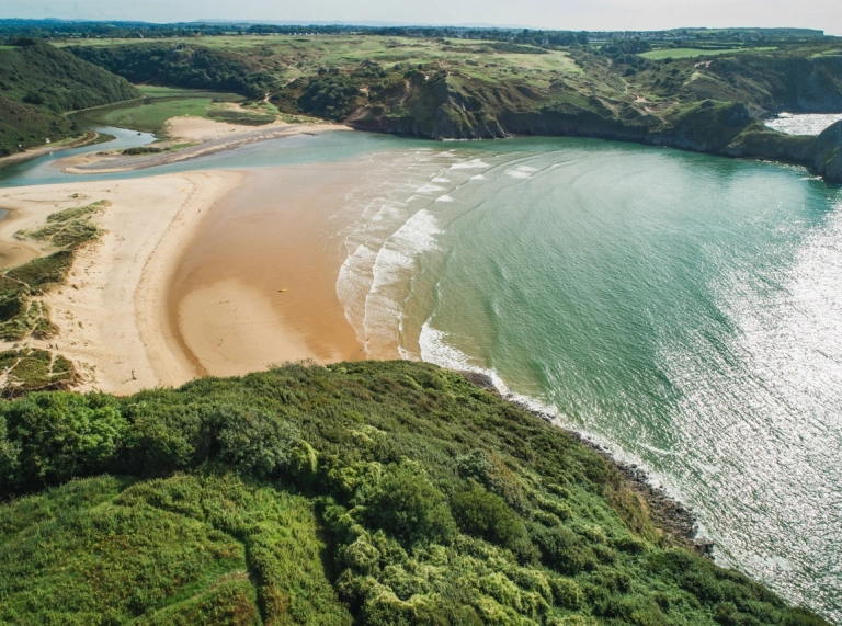
Swansea and the GowerAnchor1
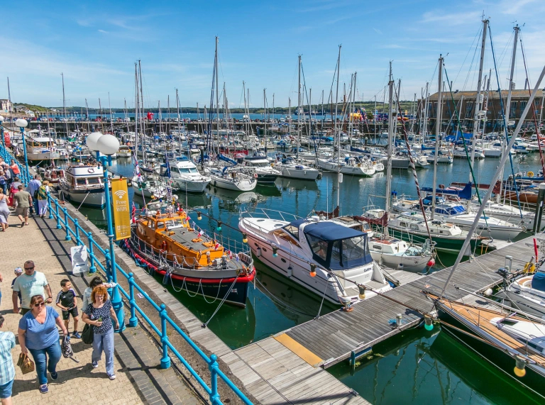
Swansea
Swansea City takes just under an hour on the train from Cardiff Central. Clients can also travel direct from Bristol Parkway, London Paddington and Manchester Piccadilly. There are train and bus links from the airport to the major stations. Clients can plan their journey with National Rail Enquiries. There is also a megabus service from Cardiff to Swansea.
The marina and beach is a 25min walk from the station. The coastal path stretches five miles (8 km) to the quaint seaside resort of Mumbles with its independent shops and Victorian Pier. Within the city, clients may wish to visit the National Waterfront Museum, which houses a vast collection highlighting Wales’ industrial and maritime heritage. Shoppers can head for Swansea Indoor Market, the largest indoor market in Wales. For art, culture and entertainment, the Glynn Vivian Art Gallery, Dylan Thomas Centre and Swansea Arena are all within walking distance.


Walk approximately one mile (1.6 km) from the city centre to Penderyn Swansea Copperworks Distillery. Set on the Hafod-Morfa Copperworks site, there are daily tours around the distillery, an exhibition area, a shop, tasting bar and a copper tunnel showing how copper was smelted.

From Swansea, travel to Dan-yr-Ogof National Showcaves Centre for Wales and Brecon using the T6 TrawsCymru bus service. Craig-y-nos Country Park and castle is a 9min walk from the showcaves. Visit our South and West Wales cities itinerary for more inspiration. Two or three night’s accommodation would allow more time to visit Carmarthen and Pembrokeshire.

Gower
Access to the north of the Gower Peninsula can be reached by the 116 bus service from Swansea city centre. To the east is Rhossili Bay and bus service 118 and 119 will travel there. Bus service 14 travels to Pennard Cliffs. A short walk away are Pennard Golf Club, Pennard Castle and Three Cliffs Bay. All buses are operated by Adventure Travel.
CarmarthenshireAnchor2
Carmarthen
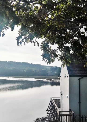
The historic market town of Carmarthen sits on the River Tywi and can be reached by train from Newport, Cardiff and Swansea. Once a regional Roman capital, the Normans too made their regional base here. Wales’ oldest surviving manuscript was written at Carmarthen Priory. It is also believed to be the birthplace of the wizard, Merlin - King Arthur's guardian who had magical powers and who supposedly lived in a cave on the hill overlooking the town. There are a series of walking trails that explore much of the town’s history. For more ideas, visit our shopping fact sheet. Visit the TfW website for more information and services at Carmarthen train station. There is a limited bus service from Carmarthen to National Botanic Garden of Wales . Bus service 279 leaves the bus station at 11:05 with the return bus leaving the garden at 16:25. For more information, visit the website’s travel page.
Laugharne
From Carmarthen, take a 45min journey to the coastal town of Laugharne using bus service 222. Dylan Thomas and his family moved here in 1949 and is where he wrote his most famous play Under Milk Wood. See how they lived at their former residence Dylan Thomas Boathouse and peer into the window of his writing shed. Visit Laugharne Castle where he wrote a collection of short prose stories, and Brown’s Hotel, his favourite drinking establishment.
Llandeilo
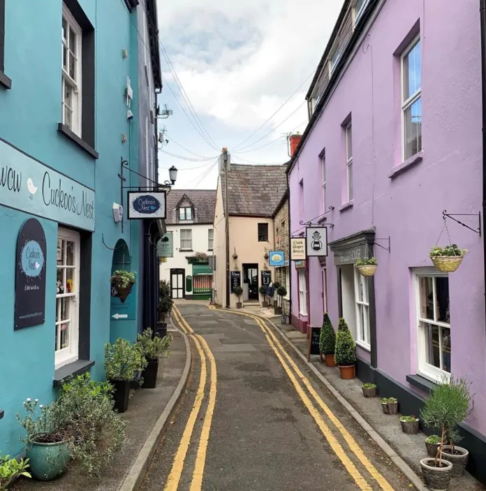
The pretty colourful market town of Llandeilo can be reached from Swansea on the Heart of Wales line. There are also a selection of buses which run from Carmarthen. Visit Traveline Cymru for a personalised timetable. The town has a wide selection of independent shops, places to eat and St Teilo’s Church. From the town, it is around a 1.5 miles (2.4 km) to attractions within the Dinefwr Estate. The walk would take around 25mins. Discover the history of Newton House in every room and visit the exhibition rooms on the first floor. Castell Dinefwr (Dinefwr Castle) is free to visit and provides views of the Tywi Valley from its hilltop.


PembrokeshireAnchor3
Pembrokeshire is home to the Pembrokeshire Coast National Park. The beautiful coastline has plenty of towns, adventure activities and a section of the Wales Coast Path. There is a toolkit to help operators arrange walking holidays. The Pembrokeshire Coast Path National Trail sits within the park and is only one of three national trails in Wales. During the summer months, a network of coastal bus services transport visitors between beaches. It’s particularly appropriate if walking a one-way stretch of the coast path.
Pembroke
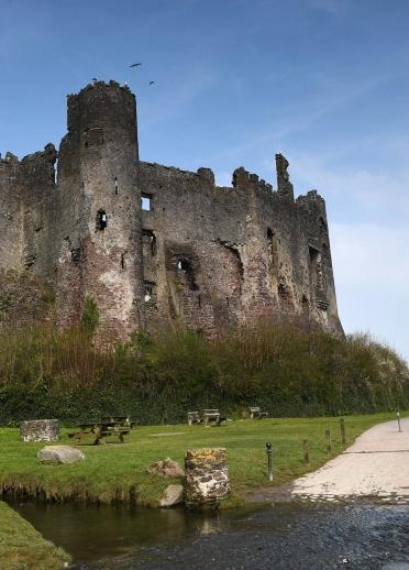
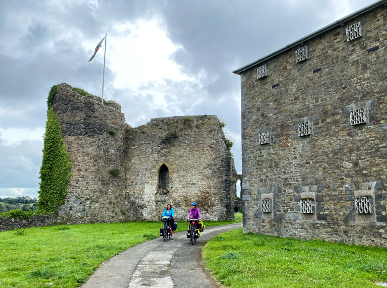
The mighty Pembroke Castle sits on the banks of the river estuary and has a labyrinth of corridors, tunnels and stairways to explore. Guided tours are available at certain times throughout the day. There is a Castle Kitchen serving home baked food and a gift shop on site. A direct train service starts from Carmarthen to Pembroke and the castle is a 15min walk.
Haverfordwest
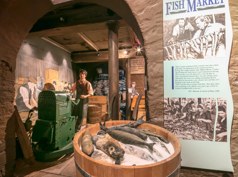
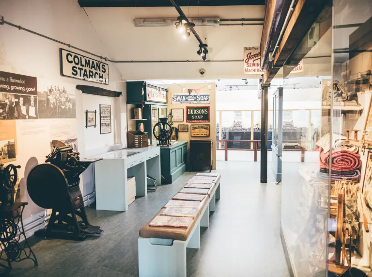
There is a direct bus service 381 travelling from Tenby to Haverfordwest. The journey takes around 1hr 5mins. Stops along the route also include Narberth, Saundersfoot and Folly Farm. The town is dominated by the Western Cleddau river and the remains of the external wall of Haverfordwest castle. Haverfordwest Town Museum is located in the former prison governor’s house and displays historical artefacts, art and photography. Haverfordwest is also the hub to travel on to other destinations around Pembrokeshire.

Milford Haven
Milford Waterfront is a 10min walk from Milford Haven rail station and has a good choice of shops, art galleries, cafés and restaurants and three heritage walking trails. Discover the history, waterways and energy of the area from the Bronze Age to the present day at Milford Haven Museum. Audio tours are available.
For more inspiration, visit our Days out in and around Tenby, Regional introduction to South West Wales for groups and Highlights of our South and West Wales cities itinerary.
Narberth
Travel direct by train from Carmarthen to Narberth. Alternatively, bus service 381 travels from Tenby to Narberth. The town centre is full of independent shops and is a 15min walk from the station. See our Shopping fact sheet for more information. Other places to see in the town is Narberth Museum and the remains of Narberth Castle. The annual Narberth Food Festival is held during the fourth weekend of September.

Saundersfoot
The harbour has undergone major re-development work in Saundersfoot. Wales International Coastal Centre offers the visitor multi-million waterfront facilities in the coastal town. The Saundersfoot Welcome and Heritage Centre offers visitors an insight into the industrial heritage of coal. Attractions also include a water sports centre, shops and eateries, a schooner with interpretation centres and an outdoor cinema, a Maritime Heritage Centre and an amphitheatre.
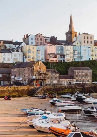
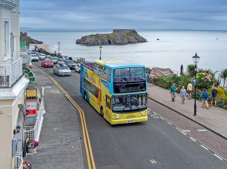
Tenby
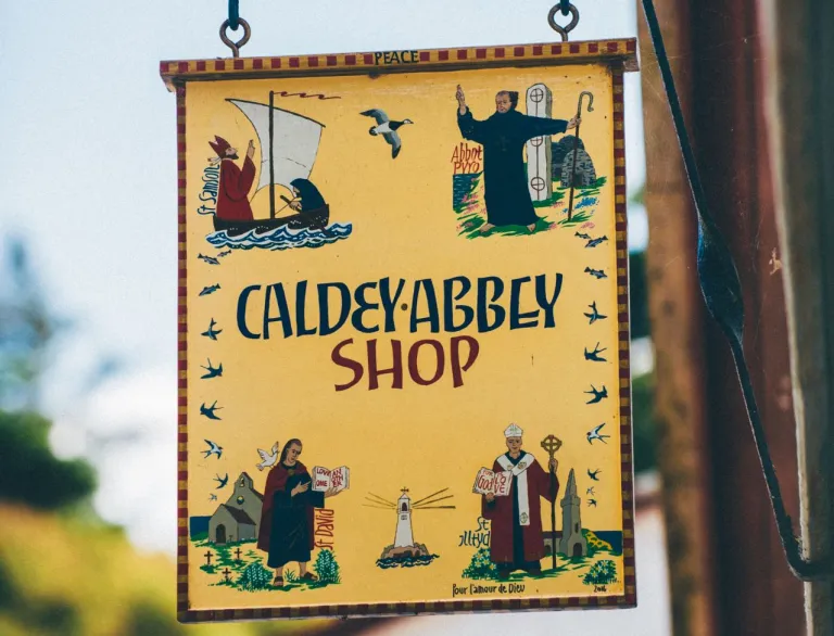
The seaside town of Tenby is a 20min train journey from Narberth or it can be reached on bus service 381. Highlights of Tenby includes Tenby Museum & Art Gallery, Harbwr Brewery and Tudor Merchant's House (booking is essential). Boat services sail from the harbour to Caldey Island, home to the Cistercian monks. As well as the harbour and beaches, there are plenty of shops and places to eat and drink in the town.

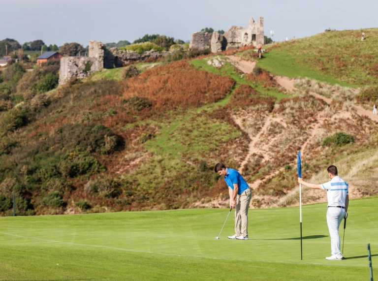
Tenby Golf Club is an 11min walk from the town centre. The 18 hole links golf course offers spectacular views of the coast.
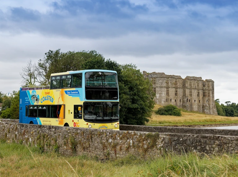
The Tenby Coaster is a great way to travel between Tenby and Saundersfoot. Clients will be able to hop on, hop off the open top bus, and admire breathtaking scenery along the way. The bus runs seven days a week, including bank holidays, from April to mid September.
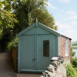
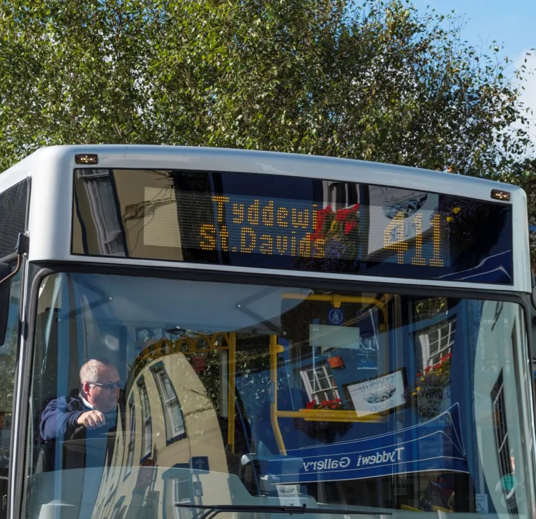
St Davids
Buses to the UK’s smallest city St Davids takes around 50mins from Haverfordwest using the T11 bus service. Highlights in the city include St Davids Cathedral, St Davids Bishops Palace and Oriel y Parc Gallery and Visitor Centre. Voyages of Discovery and Thousand Islands Exhibitions offer a variety of boat trips from the harbour, including dolphin watching and trips to Ramsey, Skomer and Grassholm Islands. For adventure in or on the water, including kayaking, coasteering, and stand-up paddleboarding, TYF Adventure operate from the High Street.


Heart of Wales LineAnchor4
The Heart of Wales Line takes a scenic route from Shrewsbury to Swansea city. The line cuts diagonally across the rolling hill country of Mid Wales with more than thirty stops through Wales. The train stops at a number of pretty towns including Llandeilo, Llandovery and Knighton. The railway line crosses two impressive viaducts, at Knucklas and at Cynghordy, and goes through six tunnels, including one on the run up to The Sugar Loaf mountain. The Heart of Wales Line Trail was created in Spring 2019 for walkers, linking stops and stations along the line. There are several methods of purchasing tickets before boarding the train. From Shrewsbury either return to Cardiff, head to London via Birmingham or head up to North Wales.
Useful linksAnchor5
Train services
Bus services
- Adventure Travel
- Dansa
- First Bus South and West Wales
- Pembrokeshire County Council – bus routes, timetables and map
- Stagecoach
- Taf Valley Coaches – serving Carmarthenshire and Pembrokeshire
- TrawsCymru
When planning a tour of Wales, check the routes and times for all public transport, and the rail network map to ensure easy travel between regions. Many locations may be geographically close but on a different branch line. Check to see if the local bus service is possible.
Explore South Wales Pass allows four days travel within a period of eight days on trains and selected bus operators in South Wales.
Explore Wales Pass allows unlimited access to Wales’ rail and bus network and discounts for participating attractions and accommodation. See the webpage for full terms and conditions of use.
fflecsi - a flexible way to plan and travel by bus on selected routes by booking a ride via the app or phone.
Trainline - provides helping visitors plan their rail journey and get live train running times, accessibility, and facility information.
Traveline Cymru – a useful website to help plan your journey by public transport
The Wales Coast Path is easily accessible using public transport.
Wales on Rails – promotes tourism in Wales using public transport and includes itineraries, attractions, rail routes and bus routes, upcoming events and you can purchase tickets.
Search for accommodation in the major cities and towns such as Swansea, St Davids, Carmarthen, Narberth, Saundersfoot, Tenby, Pembroke and Fishguard.