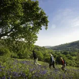
South West Wales includes Pembrokeshire Coast National Park, the Gower Peninsula and Carmarthenshire. They take in coastal areas that form the Wales Coast Path and the inland areas of the Preseli Mountains, the western edge of the Bannau Brycheiniog (Brecon Beacons) National Park and Cambrian Mountains. There are many walking paths in varied landscapes including limestone plateaus, heathlands and forests.
Three easy walks
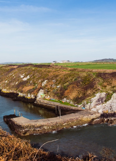
Walk one - Carew Mill Pond, Pembrokeshire Coast National Park
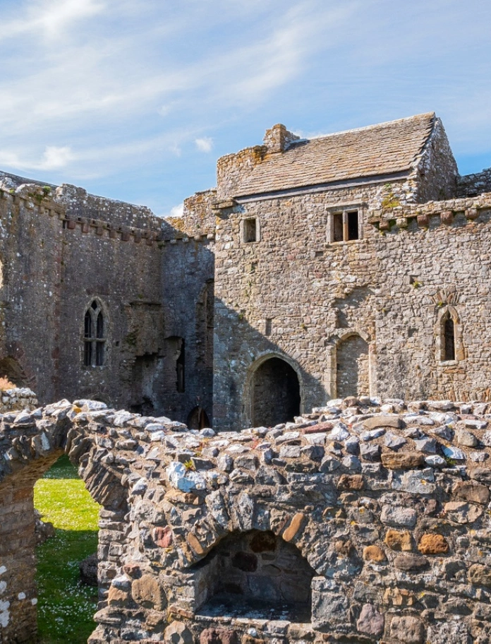
Walk alongside Carew’s medieval castle and Tidal Mill, both managed by Pembrokeshire Coast National Park and open to visitors from April to October, charges apply. The paths are open and free of charge all year.
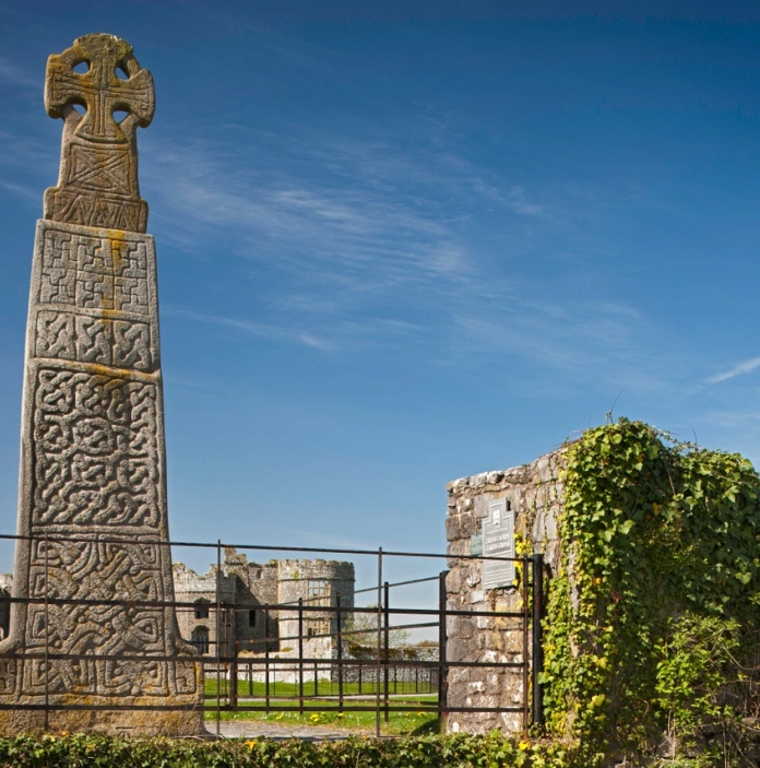
Carew Tidal Mill pond attracts many wading birds. The walk also passes the carved 11th century Christian Celtic cross, considered to be one of the three finest Celtic crosses in Wales.
Start and finish: Either Carew Castle car park or Mill Pond car park. Coach parking available.
Postcode: Carew Castle car park SA70 8SL
Grid ref: Carew Castle car park SN046036
Time: 30min
Distance: 1 mile (1.6 km) level, surfaced paths around Carew Millpond.
Toilets: opposite side of road from Carew Castle car park.
Nearest town: Pembroke.
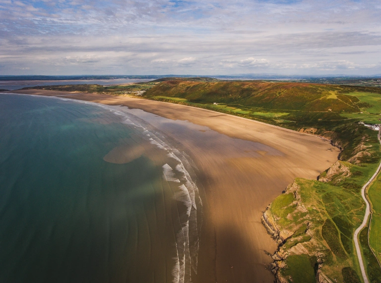
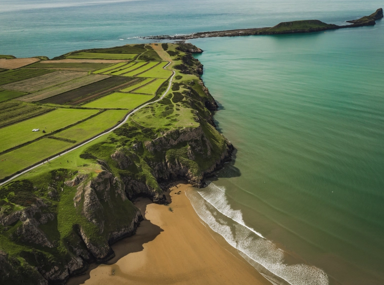
Walk two - Rhossili, Gower – serpents, seascapes and shipwrecks
A flat coastal cliff top walk towards Worms Head and return.
Leaving the National Trust car park, follow the wide flat path out towards Worms Head. Passing the National Trust shop and breathtaking views overlooking Rhossili beach. Features along the path include an iron age fort and a medieval open field strip feature called the Vile. Your clients will see sunflowers growing in season. The coastguard station overlooks Worms Head and, for the adventurous, Worms Head can be crossed at low tide. If accessing Worms Head it is advised to take care and assessment of the tides.
Start and finish: Rhossili National Trust car park, toilets available.
Postcode: SA3 1PR
Grid ref: SS413881
Time: 30min
Distance: 1 mile (1.6km)
Nearest town: Mumbles.
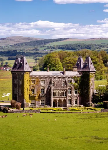
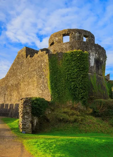
Walk three - Dinefwr Park wildlife walk, Carmarthenshire
Exploring the wildlife habitats of the estate, the medieval castle and 17th century mansion.
Dinefwr’s historic parkland is famous for its abundance of wildlife and views of the valley. It is a Site of Special Scientific Interest and in 2007 it also became the only parkland National Nature Reserve in Wales.
Main features of the walk include the fallow deer, mill pond, wildfowl on the Oxbow lakes, River Tywi, Dinefwr Castle and Newton House.
Start and finish: Dinefwr Park car park, a National Trust managed site.
Toilets: Yes.
Postcode: SA19 6RT
Grid ref: SN615224
Time: 1hr
Distance: 3 miles (4.8 km)
Nearest town: Llandeilo.
Four moderate walks
Walk one - Porthclais and St Davids, Pembrokeshire Coast National Park
Rugged coast, fields and livestock, reasonably level.
Walk out from the centre of St Davids along a country path to join the Pembrokeshire Coast Path at Porthclais. Follow the coast path to St Non’s and return to St Davids along a country path.
Porthclais harbour was the main harbour for shipping in and out of St Davids, for both pilgrims and commerce. Lime kilns surround the harbour.
St Non’s is reputed to be the birthplace of St David and a holy well can be visited on route, which tradition says sprung at the time of St David’s birth. St Non was David’s mother.
Start and finish: Oriel y Parc car park. Coach parking and toilets available.
Postcode: SA62 6NW
Grid ref: SM745245
Time: 1hr 15min
Distance: 2.6 miles (4.2 km)
Walk two - Stackpole wildlife walk, Pembrokeshire
Walking along differing wildlife habitats, limestone cliffs with breeding seabirds, beaches, dunes and freshwater lakes.
The walk follows the coast path along limestone cliffs, occasionally broken up by red sandstone. Walk along the secluded beach of Barafundle Bay, the cliffs of Stackpole Head and the grasslands of Stackpole Warren, rich in spring and summer coastal flowers.
The path descends towards the freshwater lakes of Bosherston Lily Ponds, with an elevated view of the golden sands of Broad Haven beach.
The path returns to Stackpole Quay crossing the lily ponds and Eight Arch Bridge.
Start and finish: Stackpole Quay car park. Parking and toilet facilities are also available at Bosherston and Broad Haven.
Postcode: SA71 5LS
Grid ref: SR990958
Time: 4hr
Distance: 6 miles (9.6 km)
Nearest town: Pembroke.
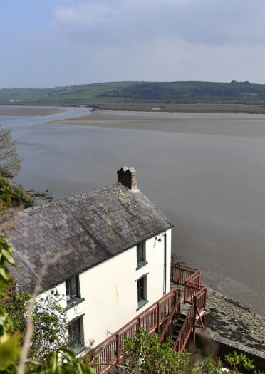
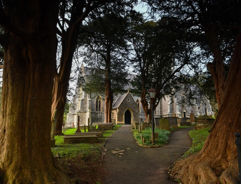
Walk three - Laugharne loop, Carmarthenshire
Relatively level ground for most of the way.
The walk follows the Wales Coast Path with views across the estuary and memories of Dylan Thomas.
Main features of the walk include Laugharne Castle and the salt marshes, Dylan Thomas writing shed and Boathouse, and St Martin’s Church, home to Dylan Thomas’s grave.
Start and finish: Laugharne Castle car park (small car park).
Postcode: SA33 4SA
Time: 1hr 30mins
Distance: 4 miles (6.4 km)
Toilets: Near car park.
Nearest town: St Clears.

Walk four - Gowerton, Three Crosses and Dunvant
Enjoy a scenic route through charming villages, open fields, and peaceful woodlands. Starting and ending in Gowerton, the loop passes through Three Crosses and Dunvant.
Clients will walk along reclaimed former mining areas which are now transformed into lush woodland, past a golf course, and cross rolling countryside.
Start and finish: Gowerton
Postcode: SA4 3AG
Time: 3-4hrs
Distance: 6 miles (10 km)
Toilets: No
Nearest town: Gorseinon
Three challenging walks
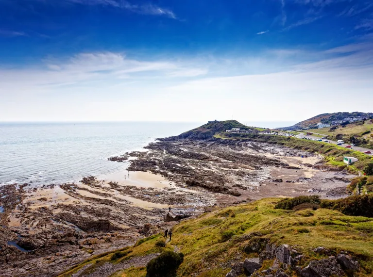
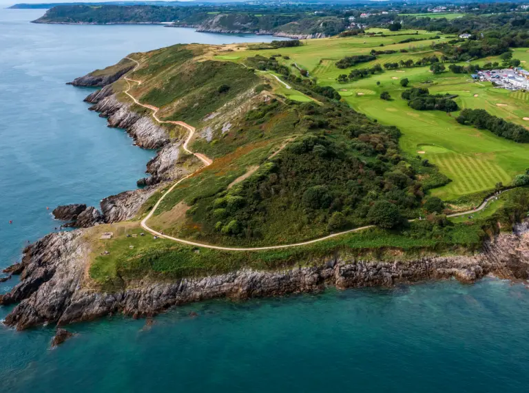
Walk one - Mumbles Hill and Caswell Bay
The walk begins at Bracelet Bay with views of Mumbles Head and its lighthouse, then climbs through Mumbles Hill Nature Reserve, passing wartime bunkers and viewpoints over Swansea Bay.
It continues through quiet suburban streets and into Bishop’s Wood Nature Reserve, offering woodland trails and glimpses of Caswell Bay. The route joins the Wales Coast Path to Langland Bay, with its beach huts and cafes. The walk then passes Rotherslade Bay and winds along the coast to Limeslade Bay.
Start and finish: Car park at Bracelet Bay. Or daily bus from Swansea.
Toilets: Yes (check website for opening times)
OS map ref: SS 62880 87317
Time: 3hrs 20mins
Distance: 6.8 miles (10.9 km).
Nearest town: Mumbles
Walk two - The Gower Way - Llanrhidian to Cheriton, Gower
Gently undulating landscape.
Features of the walk include the village of Llanrhidian and the church; Weobley Castle, a fortified 14th century manor house and Bovehill Castle, a fortified 15th century manor house. Llanrhidian Marsh is a nature reserve and Site of Special Scientific Interest.
Start and finish: Llanrhidian Church.
Parking: Llanrhidian village, Landimore.
Toilets: Weobley Castle (entrance fee).
Postcode: SA3 1ER
Time: 3hr 30min
Distance: 8 miles (13 km)
Nearest town: Mumbles.
Walk three - Carmarthen Fans, Carmarthenshire
The route is steep and strenuous, with some sections of rocky terrain and should not be underestimated. Once on the mountain you are a long way from shelter and assistance.
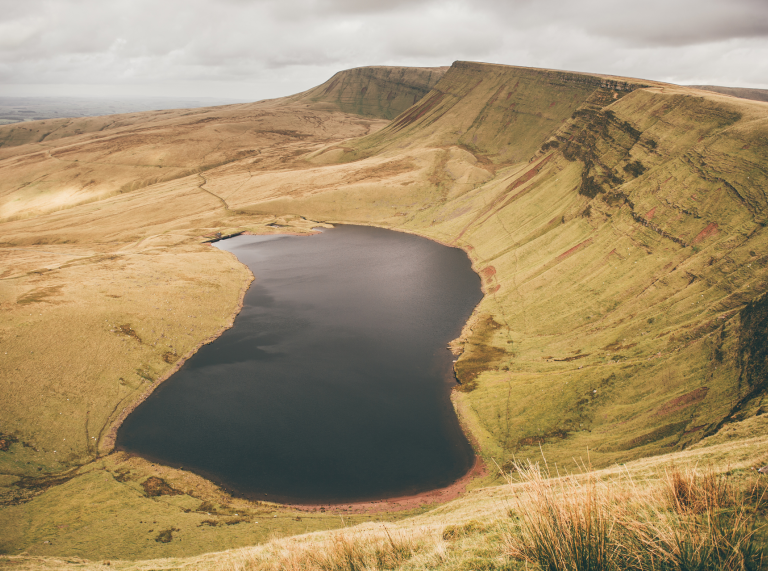
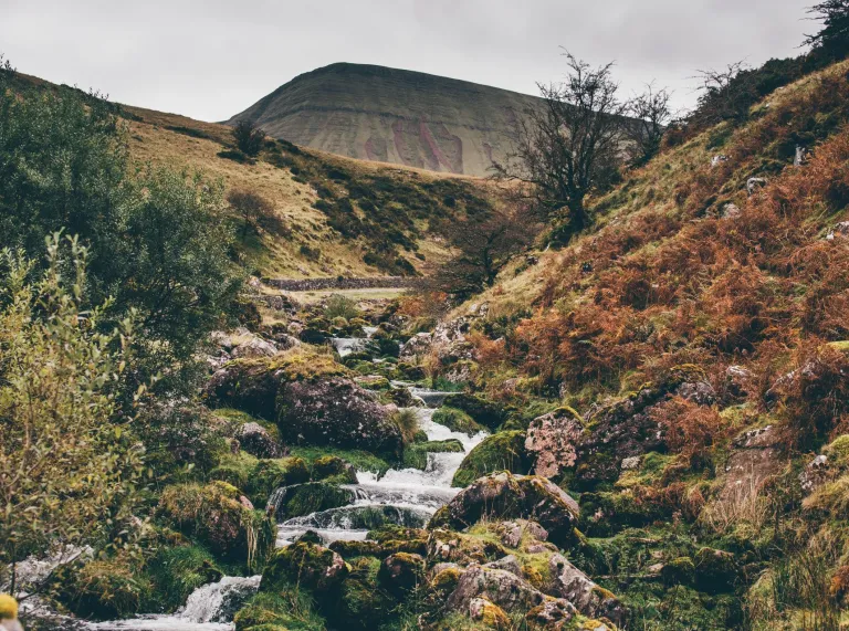
This walk covers some spectacular and remote mountain terrain of the Bannau Brycheiniog (Brecon Beacons) National Park. Walking by the lakes of Llyn y Fan Fach and Llyn y Fan Fawr, beneath the ridgeline of the Carmarthen Fans. Around the lakes red kites, buzzards, carrion crows and kestrels can be seen. The folklore legend about the lady of the lake is connected with Llyn y Fan Fach.
Start and finish: Car park provided by Bannau Brycheiniog (Brecon Beacons) National Park highlighted on the map in the link. Drivers must only use the car park provided and not park in the narrow country lanes.
Time: 5hr to 6hr
Distance: The long mountain route is 9.3 miles (15 km) with 712 metres (2,335 ft) of ascent.
Nearest town: Llandeilo.
Advise your clients to wear suitable footwear and clothes for the weather, which can be changeable. Find information on protecting and enjoying the countryside in the Countryside Code and advice on staying safe with AdventureSmart.uk.