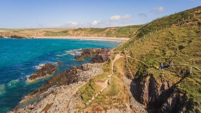
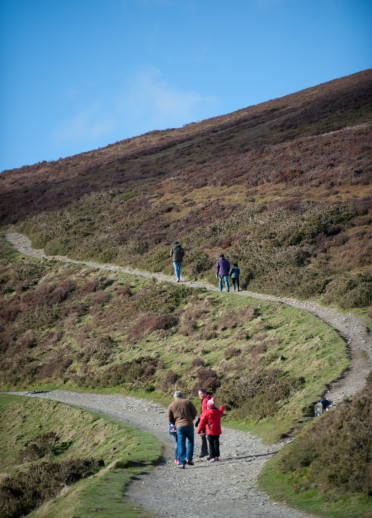
North Wales has a vast choice of walks and hikes ranging from flat wheelchair-friendly tracks to rugged rocky scrambles. Visitors have the choice of river, sandy or rocky coasts, walking through fields or the evocative remains of past industry.
Three easy walks
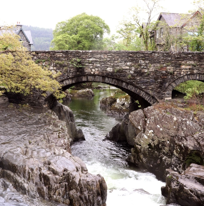
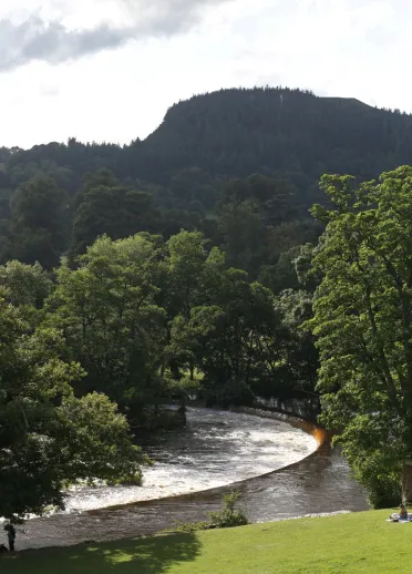
Walk one – Betws-y-Coed and Swallow Falls
A waymarked walk by the River Llugwy, passing through forest, farmland and minor roads to Swallow Falls. For a shorter walk, before crossing the farmland section, follow a path up to the minor road to return to Betws-y-Coed.
Start and finish: Pont-y-Pair car park by ‘Cunningham’s Outdoor' shop. Toilets available.
Postcode: LL24 0BB
Time: 2hr
Distance: 5 miles (6.9km)
Parking: There is a dedicated drop off point for coaches near the shopping arcade on Station Road with coach parking spaces at Cae Llan car park.
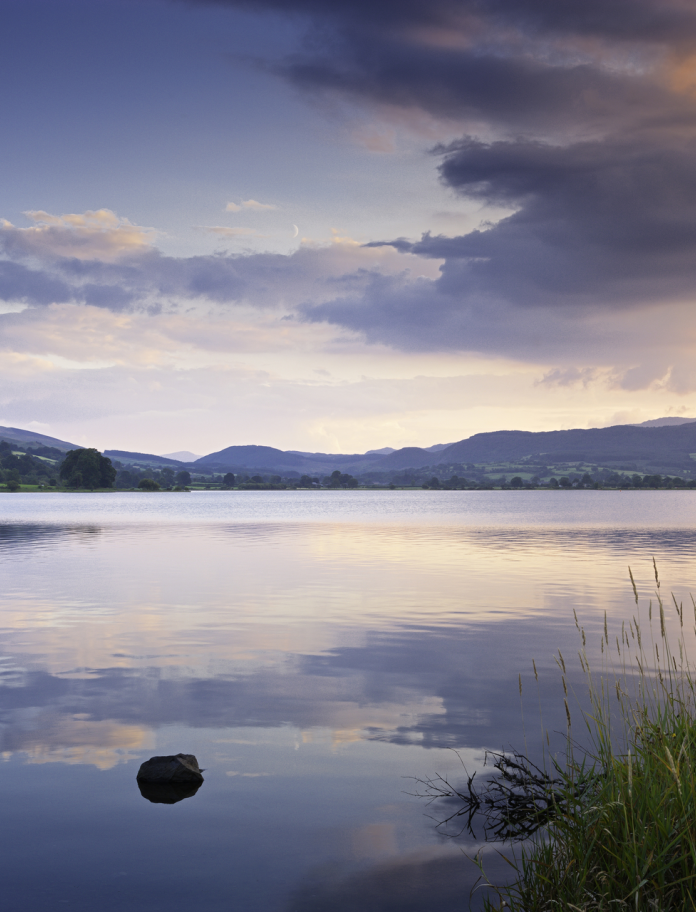
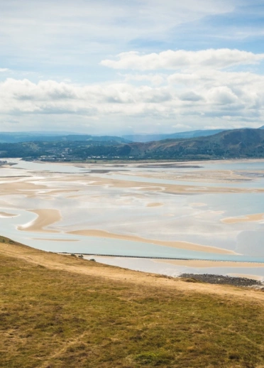
Walk two - Bala Lake, river and town
A circular walk around Bala lake, Llyn Tegyd in Welsh, following the rivers Dee and Tryweryn, before heading back through the main high street of lakeside Bala.
Start and finish: Bala Lake foreshore pay and display accessible car park.
Postcode: LL23 7SR
Time: 1hr
Distance: 2 miles (3.25 km)
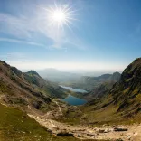
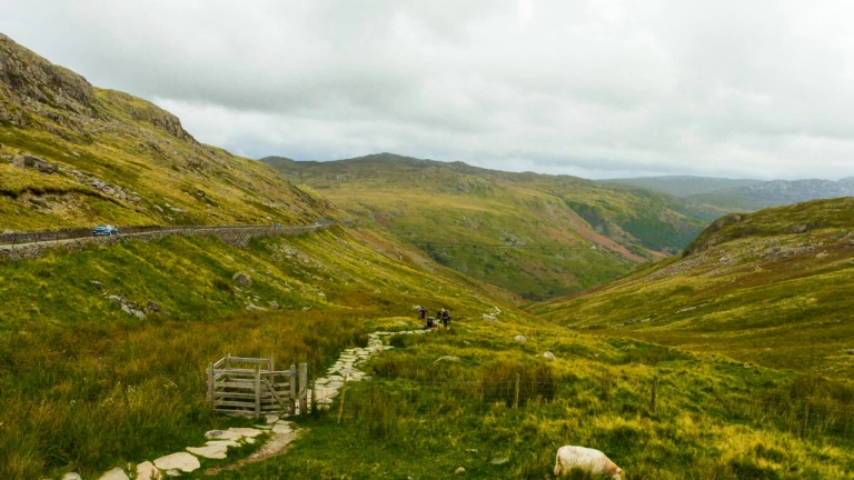
Walk three - The Miners' Track to the foot of Yr Wyddfa (Snowdon)
This out and back walk runs from Pen y Pass to Llyn Llydaw, the lake below Yr Wyddfa, on the track built to serve a copper mine during the 19th century. There are views of both the beautiful Gwynant Valley below and the famous Snowdon Horseshoe as you gently climb. Note that your clients should not continue past the miners ruins at Llydaw Lake for this walk.
Start and finish: Pen y Pass car park. Coach drop off possible. Toilets and refreshments available.
Postcode: LL55 4NY
Distance: 3.5 miles (6 km)
Time: 2hr, turn back at the lake. To continue, it gets very steep and rough.
Three moderate walks
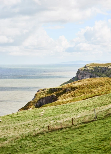
Walk one - around the Little Orme
A circular walk starting from Llandudno promenade and continuing to the summit of this limestone promontory, rising to 140 metres (450 ft), for views of the coast, mountains and rural Conwy.
Start and finish: Llandudno Promenade.
Postcode: LL30 2YG
Parking: Roadside along the promenade (coaches drop off and coach park in Builder Street).
Distance: 3 miles (5 km), uneven, steep in places and close to some cliff edges.
Time: 2hr
Refreshments: Craig y Don, Llandudno and Penrhyn Bay.
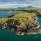
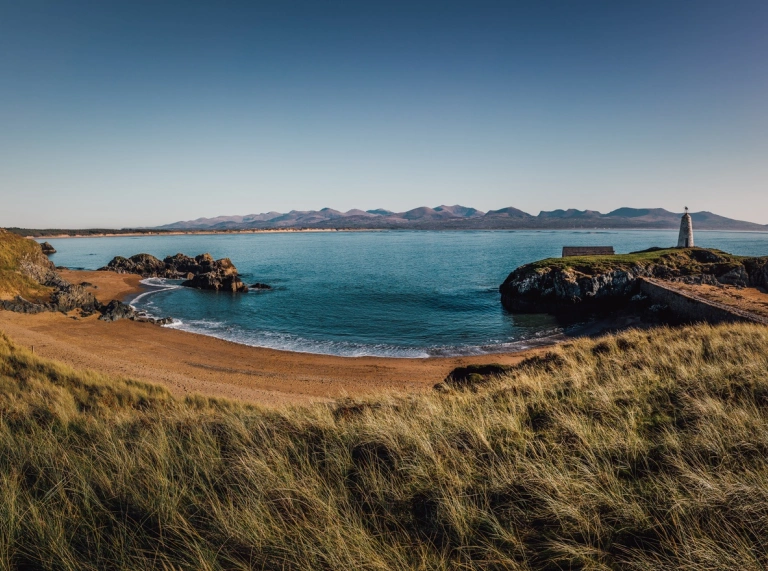
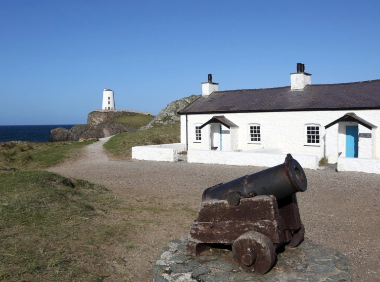
Walk two - Ynys Llanddwyn
A walk along the beach to the island named after the Welsh patron saint of love, Santes Dwynwen. A beach stroll with views over Caernarfon Bay to Eryri (Snowdonia), quaint cottages and a lighthouse.
Start and finish: Traeth Llanddwyn parking.
Postcode: LL61 6SG
Distance: 3.5 miles (5.5 km). Note that at high tide the island can become inaccessible.
Toilets/refreshments: Toilets and catering van in car park.
Time: 2hr
Parking: A large paid car park at the end of road from Newborough Village. Coach accessible but arrangements need to be made in advance with Natural Resources Wales by email or by contacting +44 (0)300 065 3000.
Note: Llanddwyn Island can get very busy during the summer months, so walking the route out of season is recommended.
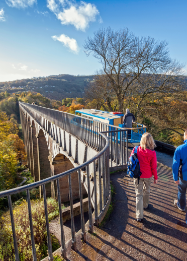
Walk three - along the Llangollen Canal and over Pontcysyllte Aqueduct
Although this walk is flat, along a canal towpath, a head for heights is needed as the path crosses the 200 year old Pontcysyllte Aqueduct, 40 metres (126 ft) high over the River Dee and a World Heritage site.
Start: Llangollen Wharf. LL20 8TA
Finish: Pontcysyllte Aqueduct. LL20 7TY
Distance: 4 miles (6.4 km)
Coach parking: Follow signs off A539 and use LL14 3NP
Time: 1hr 40mins
Note: There is also a 2 mile (3.2km) walk from Llangollen Wharf to Horseshoe Falls, which takes around 40mins. Start from Pontcysyllte Aqueduct car park (LL14 3SG) to Horseshoe Falls for a longer walk.
Three challenging walks
Rough ground and some steep inclines. Few of the challenging routes can be accessed by large coaches.
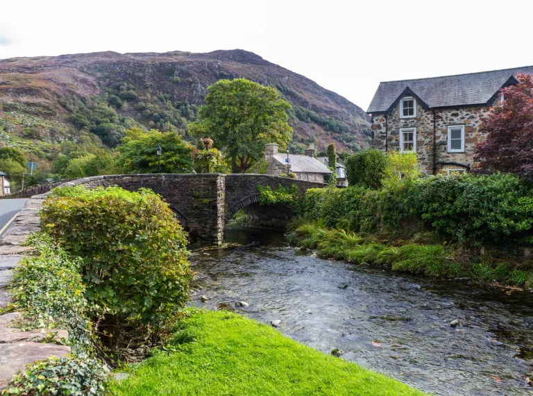
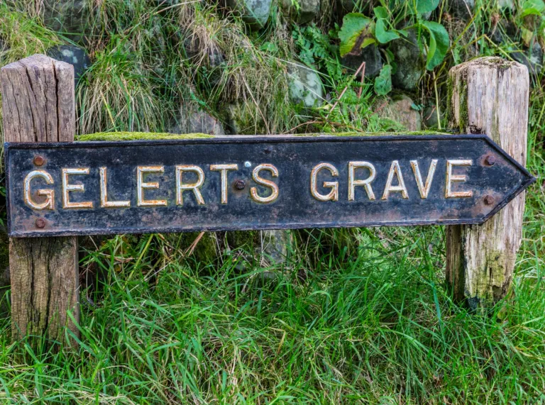
Walk one - river and mountain from Beddgelert
Follow the Aberglaslyn gorge past the grave of Prince Llewelyn’s faithful dog, Gelert, to the car park at Nantmor, where there are toilets. Then climb through old copper workings to a pass where you descend to Llyn Dinas and follow the river back to the village.
Start and finish: Car park in Beddgelert with toilets and refreshments.
Postcode: LL55 4YJ
OS grid ref: SH587481
Distance: 5.8 miles (9.3 km)
Ascent: 303 metres (1,000 ft)
Time: 4hr
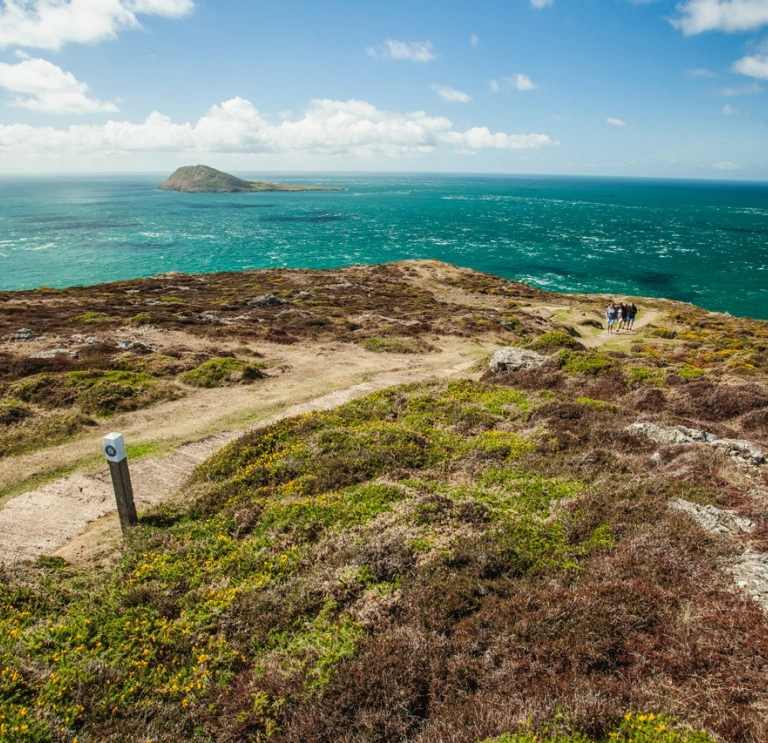
Walk two - a coastal circuit at the edge of Wales
Hike the Llŷn Peninsula’s coastal path and climb Mynydd Anel before returning through farmland and along the small valley of Afon Daron.
Start and finish: Aberdaron car park. Toilets and refreshments. Not accessible for full-size coaches.
OS grid ref: SH172 264
Distance: 9.3 miles (15 km)
Time: 4hr
Walk three - Clwydian Hills on the Offa's Dyke Path
Hike up to Moel Arthur, an Iron age hill fort and over the area’s highest peak, Moel Famau, topped by a tower built to commemorate King George III Golden Jubilee.
Start and finish: Cilcain village car park near Loggerheads.
OS Grid ref: SJ172647
Postcode: CH7 5PF
Distance: 10 miles (16.3 km)
Time: 6hr
Ascent: 750 metres (2,475 feet)
Advise your clients to wear suitable footwear and clothes for the weather, which can be changeable. Find information on protecting and enjoying the countryside in the Countryside Code and advice on staying safe with AdventureSmart.uk.