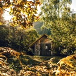
There are plenty of walks to choose from in Mid Wales, this rural area includes Bannau Brycheiniog (Brecon Beacons) National Park , the Cambrian Mountains and the Ceredigion coast.
Long distance walks include Glyndŵr’s Way, Offa’s Dyke Path, Wales Coast Path, Beacons Way and the Wye Valley Walk with a wide choice and variety of shorter walks too.
Two easy walks
Walk one - The Begwns Walk, Bannau Brycheiniog (Brecon Beacons) National Park
An easy route, just outside Bannau Brycheiniog (Brecon Beacons) National Park. This walk has panoramic views of nearly all of the National Park without the climb.
Start and finish: The Begwns car park on grass verge.
Grid ref: SO162443
Time: 1hr
Distance: 2 miles (3.2 km)
Local tip: Wander around the market town of Hay-on-Wye and grab a coffee or ice cream from Shepherds Parlour.
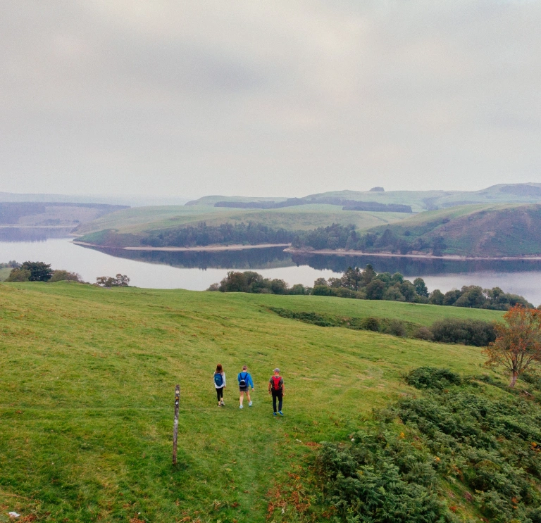
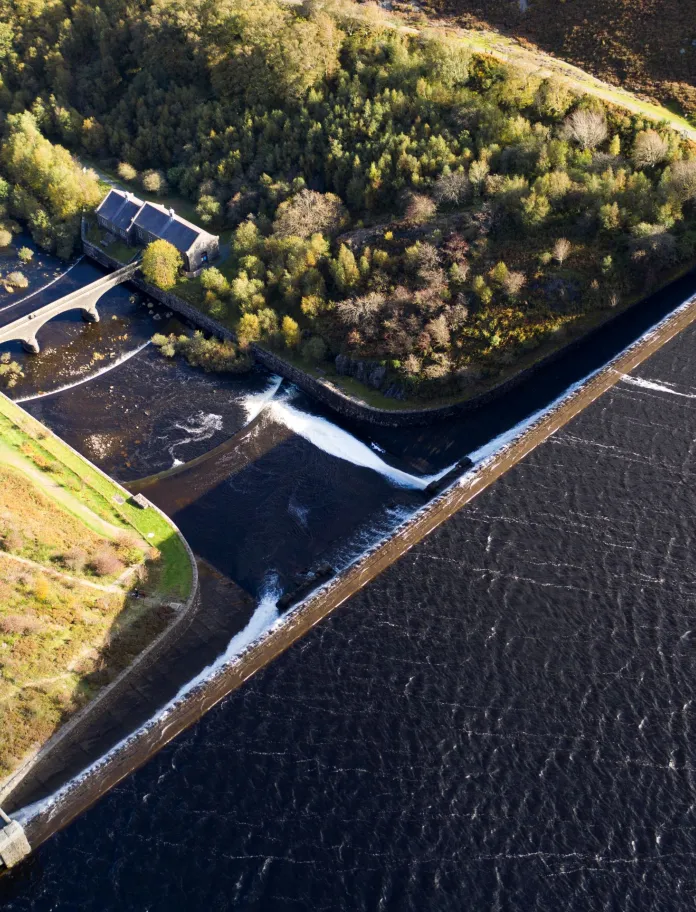
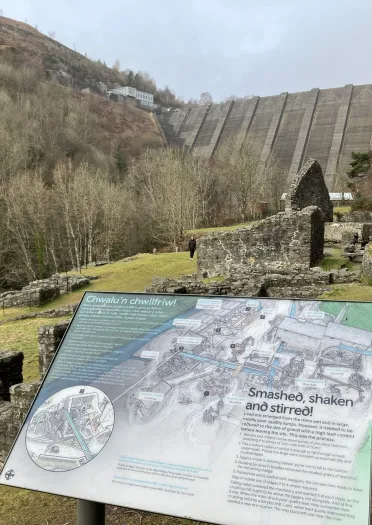
Walk two - Cnwch Wood Trail, Elan Valley, Cambrian Mountains
Cnwch Wood Trail is the easiest of the walking trails around the reservoirs and dams. The gentle walk is well-surfaced and suitable for pushchairs and wheelchair users, some assistance may be needed. Longer walks can be found on the Elan Valley website.
Start and finish: Elan Valley Visitor Centre.
Grid ref: SN928646
Postcode: LD6 5HP
Time: 30min
Distance: 1 mile (1.6 km)
Five moderate walks
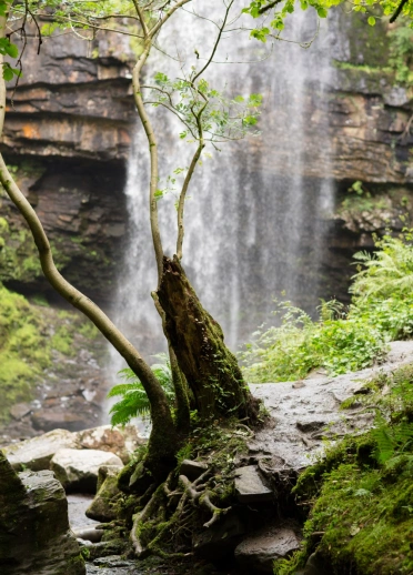
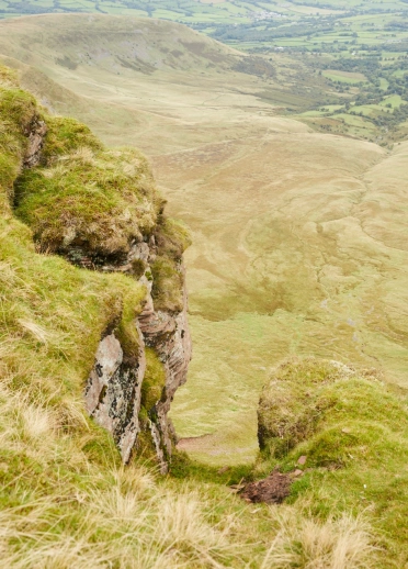
Walk one - Henrhyd Falls, Bannau Brycheiniog (Brecon Beacons) National Park
Discover the tranquil surroundings at Henrhyd Falls on this adventurous walk through to the highest waterfall in South Wales.
Start and finish: National Trust car park near Coelbren.
Postcode: SA10 9PH
Grid ref: SN853121
Time: 2hr 30min
Distance: 3.5 miles (5.6 km)
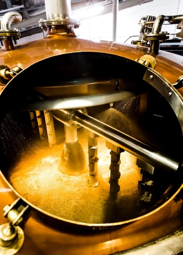
Local tip: After your walk, you could take the short drive to the village of Penderyn. Enjoy lunch at the Red Lion Inn or sample some Welsh whisky on a tour of Penderyn Brecon Beacons Distillery.
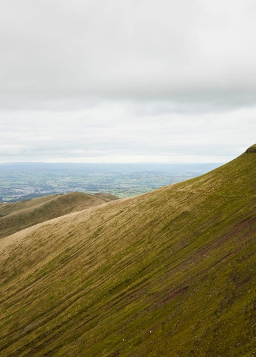
Walk two - Pen y Fan and Corn Du circular walk, Bannau Brycheiniog (Brecon Beacons) National Park
A favourite with many, this is a strenuous mountain walk on well-made footpaths to the summit of Pen y Fan and Corn Du.
Start and finish: Pont ar Daf car park (National Trust car park, charges apply)
Postcode: LD3 8NL
Grid ref: SN988199
Time: 2hr 30min
Distance: 4 miles (6.4 km)
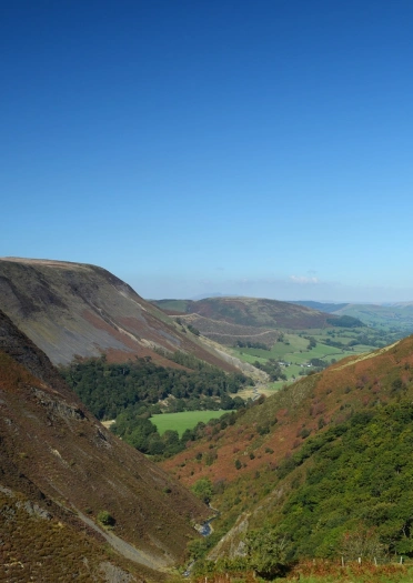
Walk three - Pumlumon Fawr, Cambrian Mountains
Pumlumon Fawr is the highest peak in the Cambrian Mountains, it is 752 metres (2468 ft), with amazing views. On a clear day you can see Cadair Idris and Yr Wyddfa (Snowdon) to the north, Pen y Fan in the south, Cardigan Bay to the west and as far south as Pembrokeshire. There are five routes to the summit of Pumlumon Fawr. The shortest route is named after Caradoc Jones, the first Welshman to climb Everest. Sunsets are amazing on the mountain. The summit has several piles of stone near it known as cairns.
Caradoc Jones Trail
Start and finish: Entrance of Maesnant near the shores of Nant y Moch Reservoir.
Postcode: Suggest not to use as covers a wider area and can lead your clients to the wrong place.
Grid ref: SN77494 87942
Time: 3hr
Distance: 3.5 miles (5.6 km)
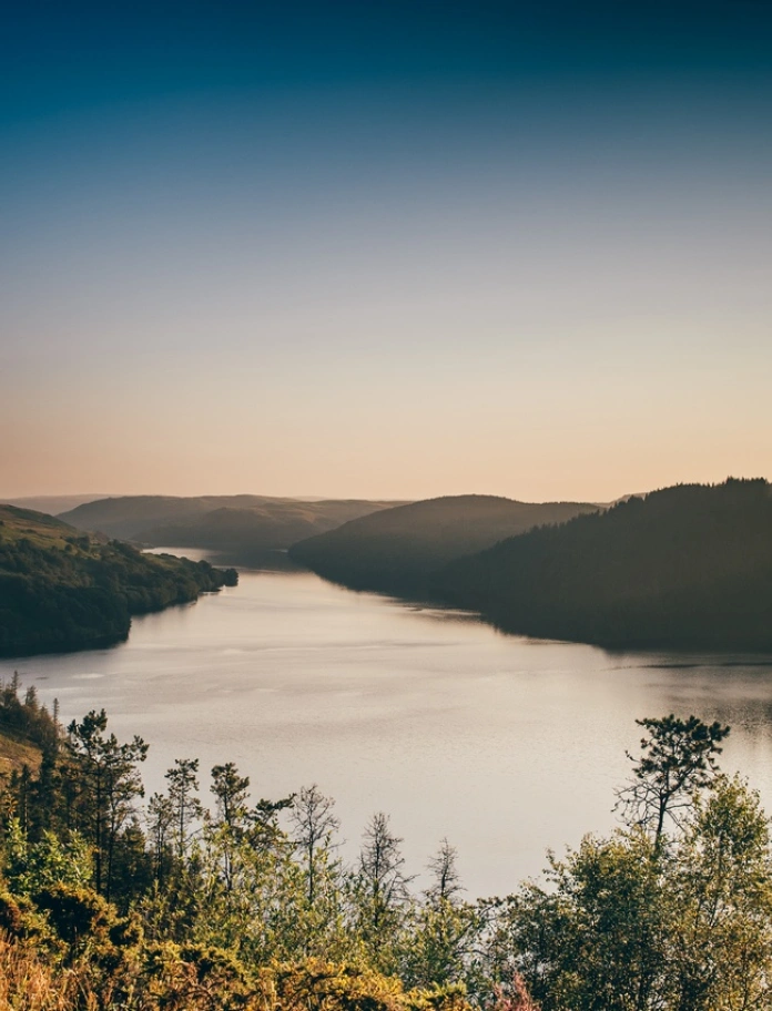
Local tip: For walks in the Cambrian Mountains contact Dafydd Wyn Morgan, an experienced local guide who's been climbing Pumlumon Fawr since 1978.
Walk four - RSPB Walk, Rhandirmwyn, Carmarthenshire
Did you know Wales had its very own Robin Hood? Twm Siôn Cati was a 16th century notorious highwayman and this walk takes you to his cave. On your walk to the cave your clients will pass through the Gwenffrwd Dinas RSPB Nature Reserve and experience the incredible birdlife, which includes red kites, pied flycatchers, redstarts, common sandpipers, dippers and grey wagtails.
Start and finish: RSPB Gwenffrwd / Dinas Nature Reserve car park.
Postcode: SA20 0PG
Grid ref: SN788471
Time: 3hr 30min to 4hr
Distance: 2 miles (3.2 km) long and has 104 metres (341 ft) of ascent and descent. Half of the recommended route is over rough terrain, but the remainder is accessible to most visitors. The boardwalk section gives good access to Alder woodland and beyond are ancient oak woodlands and the upper River Tawe.
Local tip: After your walk, check out the Llyn Brianne Reservoir then head to the Towy Bridge Inn, the nearest pub to the cave.
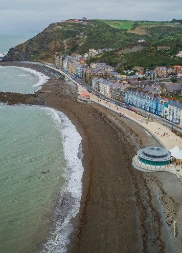
Walk five - Aberystwyth to Mynachdy’r Graig, Cerdigion Coast Path
This walk will take you along the Wales Coast Path. It starts from Aberystwyth, along Cardigan Bay coast to the former monastic grange of Mynachdy’r Graig.
Start and finish: Royal Pier, Aberystwyth.
Postcode: SY21 2AZ
Grid ref: SN581818
Distance: 10.5 miles (16.9 km). For an easier option, distance can be halved by returning by bus. Moderate to rugged paths with some steep sections.
Time: 3hr
Three challenging walks
Walk one - Glyndŵr’s Way, Cambrian Mountains
Glyndŵr’s Way is a 135 mile (217 km) long National Trail meandering through the open moorland, rolling farmland, woodland and forest of Mid Wales. Starting in Knighton and ending in Welshpool, the Trail is named after Owain Glyndŵr, Prince of Wales and medieval Welsh nationalist leader. He organised a rebellion against the English king, Henry IV in 1400. Your clients don’t have to walk the trail in one go, it can be enjoyed as a series of day walks too.
Distance: 135 mile (217 km)
Time: 9 days
A day option for Glyndŵr’s Way: Dylife to Machynlleth
Start: Dylife on road below Star Inn.
Finish: Machynlleth clock tower.
Postcode: The trail officer suggests not to use as they can cover a wide area and can lead your client to the wrong place.
Start grid reference: SN 8620 9396, bridleway from road opposite Star Inn. Leads to SN 8641 9347, the Glyndŵr’s Way National Trail.
Finish grid reference: SH 7455 0080 Machynlleth clock tower.
Time: 6hr
Distance: 14.5 miles (23.5 km)
The trail is back on the Roman Road, onto high moorland and past mysterious Glaslyn to long views towards the sea. Then onwards to the historic town of Machynlleth where Glyndŵr was crowned Prince of Wales. More information including a route map can be found in Day 5 of the itinerary for 'in the footsteps of Owain Glyndwr'. Your clients may want to visit Owain Glyndŵr Centre.
Walk two - Brecon Beacons horseshoe ridge walk, Bannau Brycheiniog (Brecon Beacons) National Park
The hike goes along a ridge, known as the Graig Fan Ddu Ridge, up the four peaks of Corn Du, Pen y Fan, Cribyn and Fan y Big, and down into the peaceful Neuadd Valley. The circular walk is through wild moorland, up steep rocky peaks and offers breath-taking views of the valley and the surrounding hills.
Start and finish: Taf Fechan car park.
Postcode: CF48 2UT
Grid ref: SO038169
Time: 4hr 30min to 5hr 30min
Distance: 10 miles (16 km)
A challenging upland walk that includes steep climbs and a flat ridge, walking on made and unmade footpaths. Sturdy boots, warm clothing and good waterproofs are essential.
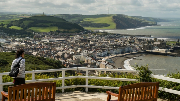
Walk three - Aberystwyth to Ynyslas, Ceredigion Coast Path
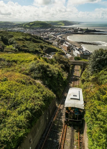
This route follows the undulating contours of cliffs and slopes to Borth passing over Craig Glais, or 'Constitution Hill'. Aberystwyth Cliff Railway can take the effort out of a steep climb to the summit, and the Camera Obscura is an alternative way to enjoy the panoramic views of Cardigan Bay and the town of Aberystwyth below.
Start: Aberystwyth bandstand, directly beneath the canopy.
Start OS grid ref: SN 58325 82002
Start postcode: SY23 2BX
Finish: Ynyslas National Nature Reserve Visitor Centre.
Finish OS grid ref: SN 60940 94101
Finish postcode: SY24 5JZ
Distance: 11.7 miles (18.7 km)
Time: 5hr
Local tip: Take a trip from Aberystwyth on Vale of Rheidol Railway to Devil's Bridge.